- Install and launch QGIS.
- Right click on XYZ Tiles from the Browser palette and choose “New Connection”.
- Fill in a name and the URL and click the OK button. (see list below)
- Expand the XYZ Tiles section in the Browser palette and double-click on the desired map or drag it and drop it in the Layers palette.
- Zoom to the desired area of interest.
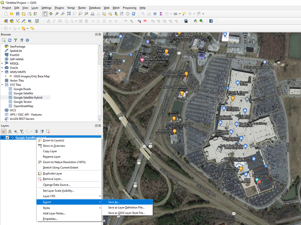
- Right-click on the layer in the Layers palette and choose Export > Save As.
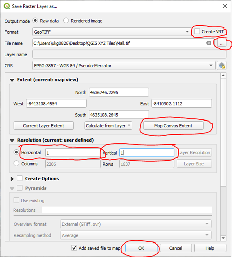
- Uncheck Create VRT. Click the button with 3 dots next to the file name blank and choose a file name and location. Click the “Map Canvas Extent” button to set the area to only what’s visible in your map view. Fill in a Horizontal and Vertical resolution. A value between .1 and 1 works well for relatively small areas. The smaller the number, the higher the resolution and larger the file size. Click the OK button.
Here is a list of useful URLS:
- Google Maps: https://mt1.google.com/vt/lyrs=r&x={x}&y={y}&z={z}
- Google Satellite: http://www.google.cn/maps/vt?lyrs=s@189&gl=cn&x={x}&y={y}&z={z}
- Google Satellite Hybrid: https://mt1.google.com/vt/lyrs=y&x={x}&y={y}&z={z}
- Google Terrain: https://mt1.google.com/vt/lyrs=p&x={x}&y={y}&z={z}
- Google Roads: https://mt1.google.com/vt/lyrs=h&x={x}&y={y}&z={z}
- Open Street Maps: https://tile.openstreetmap.org/{z}/{x}/{y}.png