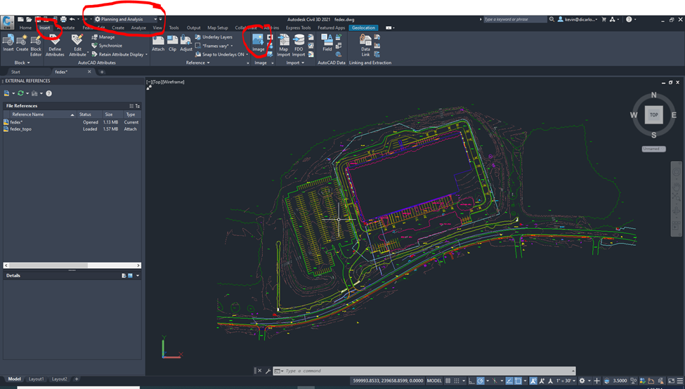
- Use MAPIINSERT from the command line or use the insert image option from the Insert toolbar in the Planning and Analysis workspace.
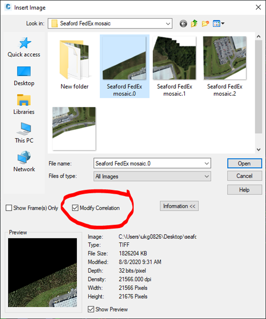
- Select the georeferenced image and make sure “Modify Correlation” is checked.
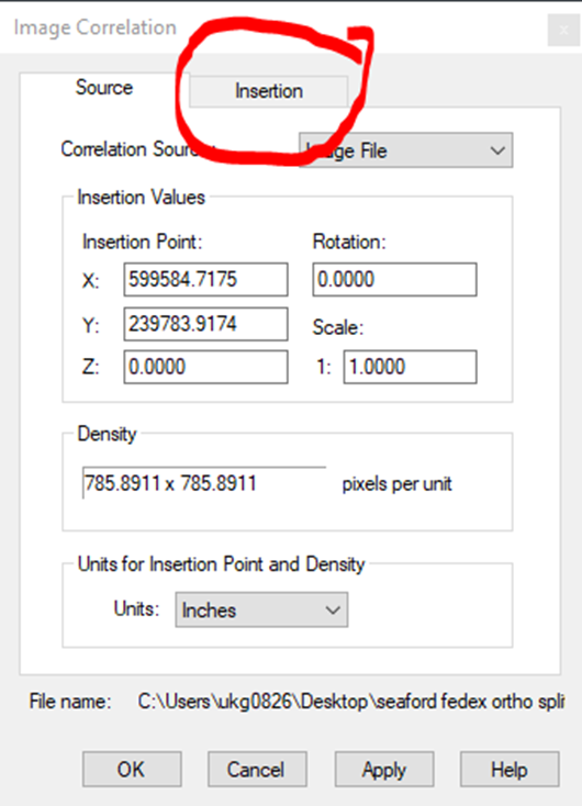
- In the Image Correlation dialog box, choose the Insertion tab.
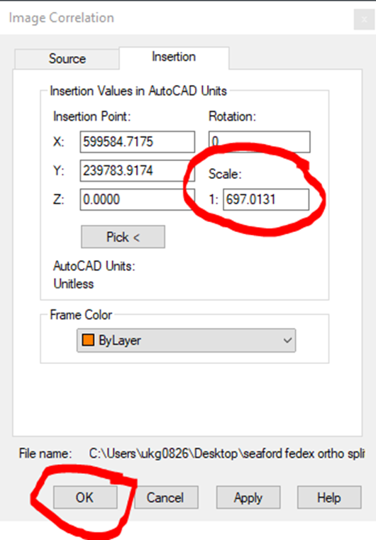
- In the insertion tab, copy the number from the “Scale” field and then click the OK button.
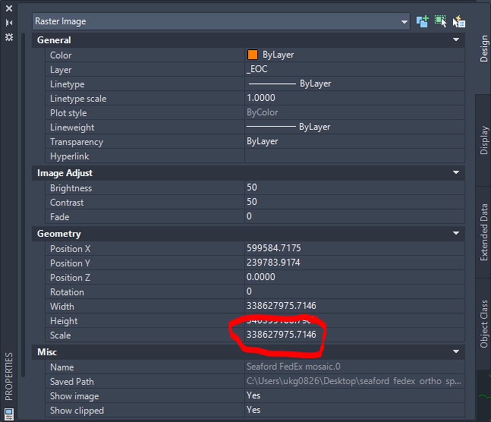
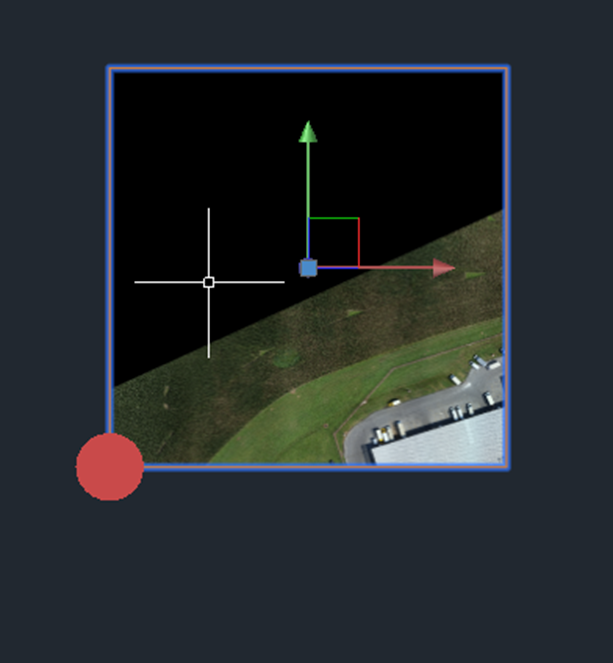
- Hold Shift and left-click on the image to select it. It will have a blue outline.
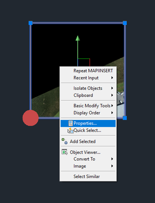
- Right-click on the selected image and choose “Properties”.
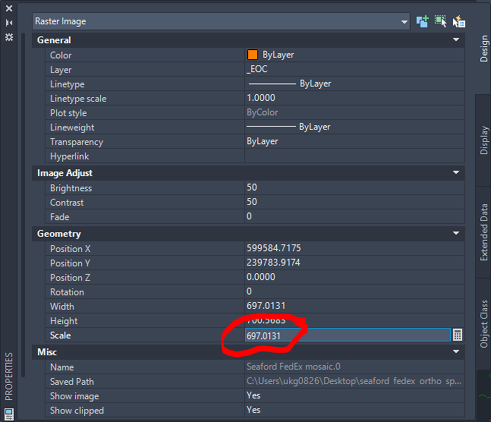
- In the properties box, find the “Scale” field in the “Geometry” section. Replace the value with the one copied from the “Scale” field on the “Insertion” tab of the “Image Correlation” box from step 4 and press ENTER on the keyboard.
English